 Ha Stone
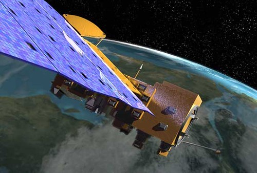
The high-resolution satellite network is set to revolutionize Earth observation capabilities, enhancing data collection and analysis.
Overview of Iran’s Satellite Network
Iran has made significant advancements in its satellite technology, particularly with the development of a high-resolution satellite network aimed at Earth observation. This initiative is part of the country’s broader strategy to enhance its capabilities in remote sensing and data collection.
The satellite network is designed to provide detailed imagery and information about various geographical areas, which can be beneficial for numerous applications, including:
- Agriculture: Monitoring crop health and managing irrigation more effectively.
- Environmental Monitoring: Tracking changes in land use, deforestation, and pollution levels.
- Disaster Management: Assessing damage after natural disasters and aiding in emergency response efforts.
- Urban Planning: Informing infrastructure development and public services.
By enhancing its high-resolution satellite network, Iran aims to reduce its reliance on foreign satellite imagery and boost its self-sufficiency in data collection. The capabilities of these satellites promise to deliver unprecedented insights into both natural and urban environments, potentially positioning Iran as a key player in the field of satellite technology.
As the demand for accurate and timely Earth observation data continues to rise, the effectiveness and reliability of Iran’s satellite network will be crucial in determining its long-term viability and impact.
Benefits of High-Resolution Satellites
The development of a high-resolution satellite network brings several significant benefits that enhance Earth observation capabilities. These advancements not only improve data collection but also support various sectors that rely on precise geographic information.
- Enhanced Imagery Quality: High-resolution satellites capture detailed images that allow for better analysis of land use, urban development, and environmental changes. This is crucial for researchers and policymakers who need accurate data to make informed decisions.
- Improved Disaster Management: With the ability to monitor natural disasters in real-time, a high-resolution satellite network can provide timely information that helps in managing emergencies, coordinating response efforts, and planning recovery strategies.
- Support for Agriculture: Farmers can utilize data from high-resolution satellites to monitor crop health, optimize irrigation, and increase yields. This technology enables precision agriculture, which can lead to more sustainable farming practices.
- Urban Planning: City planners can benefit from the detailed imagery provided by high-resolution satellites to design smarter, more efficient urban spaces. This includes understanding traffic patterns, infrastructure needs, and environmental impacts.
- National Security: High-resolution satellites play a vital role in national security by enabling surveillance and reconnaissance capabilities that help monitor borders and track potential threats.
Overall, the investment in a high-resolution satellite network presents substantial advantages that can significantly contribute to various fields and improve overall quality of life.
Challenges in Satellite Development
The development of a high-resolution satellite network presents several challenges that must be addressed to ensure its success and efficacy. These challenges range from technical difficulties to geopolitical concerns, which can significantly impact the implementation process.
- Technical Complexity: Designing and deploying satellites capable of high-resolution imaging involves advanced technology. Ensuring that these satellites can operate effectively in space, withstand harsh conditions, and produce reliable data requires significant investment in research and development.
- Cost Implications: The financial burden associated with creating a high-resolution satellite network can be substantial. From manufacturing to launching satellites, the expenses can escalate quickly, making it essential to secure adequate funding and support.
- Regulatory Hurdles: Navigating international regulations surrounding satellite launches and operations can pose additional challenges. Compliance with treaties and agreements is essential, but can be complicated by varying policies among nations.
- Geopolitical Tensions: The strategic nature of satellite technology often attracts scrutiny. Countries may fear the potential for surveillance or military use of high-resolution capabilities, leading to diplomatic tensions that could hinder cooperation.
Addressing these challenges is crucial for the successful deployment and operation of a high-resolution satellite network, which could enhance Earth observation capabilities and provide valuable data for various applications.
Impact on Global Earth Observation
The development of a high-resolution satellite network by Iran marks a significant advancement in global Earth observation capabilities. This initiative has the potential to enhance various sectors, including agriculture, urban planning, and environmental monitoring.
One of the primary impacts of this network is its ability to provide detailed imagery that can help in assessing land use changes and tracking natural disasters. With improved resolution, researchers and policymakers can obtain actionable data that influences decision-making processes. Some key areas that may benefit include:
- Agriculture: Farmers can utilize precise satellite imagery to monitor crop health, optimize irrigation, and increase yields.
- Urban Planning: City planners can analyze urban sprawl and infrastructure development more effectively, leading to sustainable growth.
- Environmental Monitoring: Authorities can better track deforestation, water resources, and pollution levels, aiding in conservation efforts.
Moreover, the high-resolution capabilities of this satellite network will facilitate international collaboration. Countries can share data for climate research, disaster response, and humanitarian aid, fostering a cooperative approach to global challenges. However, it is essential to address the geopolitical implications of Iran’s advancements in satellite technology, as they may raise concerns among neighboring nations and the international community.
Future of Space Technology in Iran
The development of a high-resolution satellite network marks a significant step forward for space technology in Iran. As the nation continues to invest in its satellite capabilities, the implications for various sectors are profound. This network not only promises enhanced Earth observation but also places Iran among the growing list of countries advancing in space technology.
One of the most exciting prospects of this initiative is its potential to bolster scientific research. High-resolution satellites can provide data critical for environmental monitoring, agricultural planning, and disaster management. With accurate imagery, researchers can track changes in land use, monitor climate change effects, and respond more effectively to natural disasters.
Furthermore, the high-resolution satellite network is likely to play a vital role in enhancing national security. By providing detailed reconnaissance capabilities, it allows for better surveillance of borders and critical infrastructure. This technological edge can serve as a deterrent against potential threats, reinforcing Iran’s position in the region.
However, the success of this high-resolution satellite network will depend on overcoming existing challenges, including technological limitations and international sanctions. As Iran continues to navigate these obstacles, the future of space technology in the country appears promising, with potential partnerships and collaborations that could further enhance its capabilities.
- Scientific Research: Enhanced data for environmental monitoring.
- National Security: Better surveillance and reconnaissance.
- Potential Collaborations: Opportunities for international partnerships.
By NASA Goddard Photo and Video via Openverse